
The Isle of Portland, Dorset
26th-29th May 2025, written by Melanie Hayes

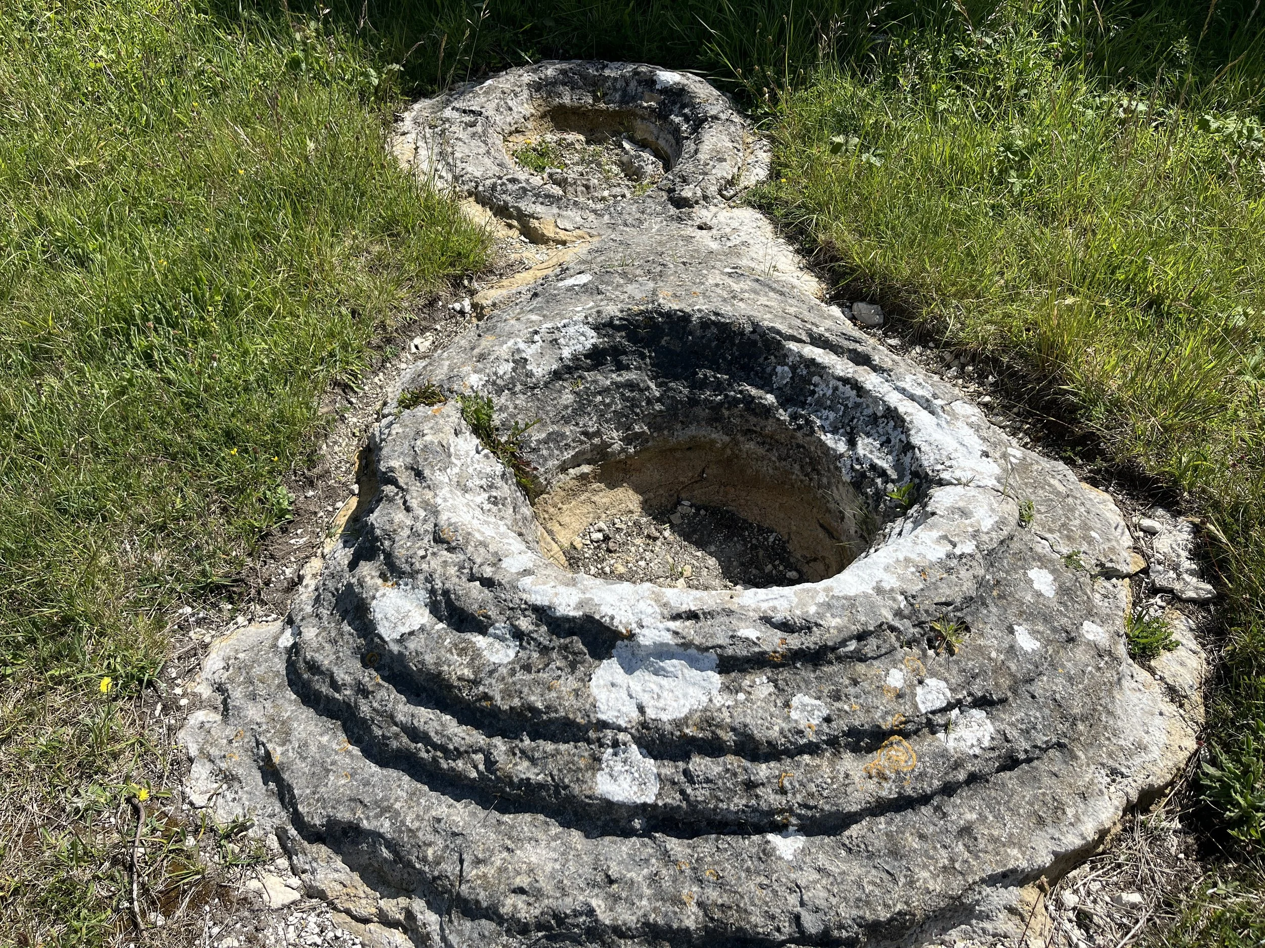
Portland Stone facies, photo: Ruth Siddall.
From Sir Christopher Wren to Sir John Soane, Scott Tallon Walker to Grafton Architects, Portland stone has long been recognised by architects and stone masons alike for its remarkable qualities as a building stone. Varying from the rough but strong and weather-resistant nature of the roach bed, more often exploited in engineering work, the fine even-textured Whitbed, with scattered shelly fossils, most prized among seventeenth- and eighteenth-century practitioners as a dimension stone, to the base bed, or ‘best bed’ which was largely reserved for statuary work, this white-grey oolitic limestone has been extensively employed in classical architecture across Britain and Ireland
In May 2025 members of the STONE-WORK team travelled to the Dorset coast to gain a greater understanding of the geological nature of the stone, the ongoing history of its extraction and the resulting impact on its use in building.
The Portland Stone Group
The Portland Limestone Group represents a sequence of sandy limestones clays and oolitic limestones overlying the deeper marine facies of the Kimmeridge Clay. Portland Stone, on the Isle of Portland formed in a marine environment, known as a carbonate ramp, on the floor of a shallow, warm sub-tropical sea. Calcium carbonate (which is the same mineral that forms the bulk of chalk, many marbles, travertine and limescale in kettles (Hunt, 2014)) accumulations gradually built up around particles of sand or organic materials, such as shell fragments to form spheres or egg shaped ooliths, billions of which cemented together, or lithified, to form the oolitic limestone. The degree of cementation in Portland stone is such that it is sufficiently well cemented to allow it to resist weathering, but not so well cemented that it cannot be readily worked (cut and carved) by masons (Godden, 2012).
Portland stone contains fossils that were endemic to the Portland seas (i.e. Solenopora portlandica, Aptyxiella portlandica) and therefore their presence provide immediate identification and provenance of this stone. It should be noted that the facies of the ‘type’ Portland Stone Formation on the Isle of Portland is distinct from that found (and quarried) on the Isle of Purbeck (‘Purbeck-Portland Stone’), the Vale of Wardour (Chilmark and Tisbury Stone), Oxfordshire and Buckinghamshire.

The building stones come from the Portland Stone Formation which is the upper part of the Portland Limestone Group. The lower section (Portland Sand Formation) is not worked for building stone. The upper Freestone Member is composed of the Base Bed Freestone, Curf & Little Roach, Whit Bed (Whitbed) Freestone and Roach. The Roach is overlain by the Purbeck Group ‘Caps’. The thickness of the Freestone beds varies across the Isle of Portland and the Curf is sometimes not present. The Portland Stone Formation is overlain by the basal Purbeck Group.
According to Cope (2016, 15) ‘the best freestones (stone that can be worked in any direction) are oolites with little space between individual ooliths. Microscopic examination shows that ooliths have been bored out and the borings subsequently infilled by calcite. This calcite is what gives Portland Stone its excellent weathering properties’.

A chart of the Isle Road and Race of Portland with the shambles & c., 1779, Portland Museum.
The Isle of Portland, the Landscape of Quarrying
Described by Thomas Hardy as ‘the peninsula carved by Time out of a single stone’, the Isle and Royal Manor of Portland is a craggy (and often windswept) tombolo or tied Island, which projects out into the English Channel off the South Dorset coast. Connected to the mainland by Chesil beach at the north end, with Portland Bill at the southern tip of the Island, its rugged coastal landscape of cliffs and weares has been shaped by both geological processes and human interventions alike. As the very bedrock of the island, the Portland stone industry, which continues to this day, has left an indelible mark on both people and place.
“There I went to the hewers of stone, which was quarried for the reparation of St Paules Church in London. There were about 200 workemen, some hewing out of the cliffe aloft, some carryeing down, others ladeinge (loading). Some stones there were, ready squared and formed, of 9, 10, & 11 tone weight as they said; some of them ready squared aloft and sent downe in carts made of purpose. Other rough pieces as they were hewn out of the rocke, were tumbled down to bee squared belowe. ”
Although Portland stone had been used locally since the middle-ages, and by Inigo Jones in the early 17th century, it was not exploited on a large scale until the late 17th century for the rebuilding of London following the Great Fire of 1666. The immense quantities required, most notably for the rebuilding of St Paul’s Cathedral, meant stone was extracted (under Royal Warrant and so exempt from duties paid for the benefit of the Islanders) from the Crown quarries on the East Weare but also from common land, where Portlanders were entitled to dig and take stone for their own use. This laid the foundation of the quarrying industry which would flourish on the island for more than two centuries, but also sparked discontent among the locals over the threat to their ancient privileges and traditions.

King Barrow Quarry, East Weare, quarried out in the 19th century.
This large-scale exploitation continued in the 18th century, leading to much physical and social change on the island. The clearing of overburden and extraction of the stone led to the destruction of arable land, as did the building of roads to the piers. The overburden, or waste, which was also used to build these roads, was often thrown over the cliffs onto the weares below, leading, it is believed, to an increase in landslips, which are a natural geological process, and the erosion of the coastline. A major landslip in February 1696, which destroyed roads, piers and cranage for loading the stone, led to works being halted at St Paul's for over a year, while the Great Southwell Landslip of 1734 was one of the largest ever in the United Kingdom. These slips exposed fresh faces of stone, often along the natural joints and gullies in the rock, beginning the process of extraction again (Miles, 2019, 11-15).

East Weare, above Durdle Pier.
As the older quarries in the north-east of the Island became exhausted, quarrying activities spread to the north-west and centre of the island, and later south, as far as Portland Bill, where activities continued into the 20th century, the remnants of which can still be seen today, discarded throughout the landscape.

Portland Bill, Derrick crane, and Portland Bill Lighthouse, 1906.


Discarded block at Admiralty, showing marks left by plug and feathers splitting (top l.); stone tracks at Admiralty Quarry, used to support carts (top r.); Discarded blocks at King Barrow Quarry (bottom l.) and Portland Bill (bottom r.), showing kevel tooling marks.
Durdle Pier
Durdle Pier is the last remaining example of a late 17th or early 18th century shipping quay on the east side of Portland. Along with King’s Pier to the north-east, Durdle pier was the main quay from which the stone was loaded on to ships, bound for London and St Paul’s Cathedral. Referred to as ‘Dirtle key’ on Roper’s plan of 1745, later maps show tracks from various stone-working sites in East Weares converging on the site.

Detail, A chart of the Isle Road and Race of Portland with the shambles & c., 1779, Portland Museum.
Today remnants of a timber loading crane, or derrick, by Galpin of Dorchester (1840-70, at least the third on the site), which was destroyed by sea in 2014, are scattered around the site. The crane had been used by fishermen to launch boats (Moyes, 2019, 52). A World War II pillbox (constructed in 1940-1) stands at the edge of a cliff south of Durdle Pier. Built of concrete and Portland stone it was camouflaged to blend in with the boulder strewn area of the Weares.[1]


Durdle Pier, remnants of a timber derrick, destroyed in 2014 and iron winch; WWII Pill Box (bottom r).
Nicodemus’s Knob and Admiralty Quarry

Nicodemus Knob showing the Portland Limestone Formation, Ruth Siddall.
Nicodemus Knob is all that remains of Admiralty Quarry, which was quarried-out in the 19th century. It is not known why it was left standing, but it possibly acted as a shipping beacon. It is illustrative in exposing a succession through the upper part of the Portland Group, and is capped by a single block of the Skull Cap at the base of the Purbeck Group. The Portland Freestone Formation is almost 6m thick here, however the Whitbed is rubbly and shelly and was probably not a high-quality building stone.
King Barrow Quarry

King Barrow Quarry.
The abandoned quarry at King Barrow, East Weare, represents some of the oldest quarries exposed on the island. Although there is a large amount of discarded block, much of the original faces are now obscured by rubble and overgrowth.

Discarded Roach Block, King Barrow Quarry.
Of interest is the small quarry at the SW of the site where circular burrs of algal mounds that once surrounded the Protocupressinoxylon purbeckensis fossil trees survive on the quarry bed. The trees were preserved in the Great Dirt Bed of the Purbeck Caps, a unit which overlies the Skull Cap. Circular ‘burrs’ of algal thrombolite accumulated in the marshy ground around the tree stumps. Trees were found growing, vertically, in life position, but these large fossils were excavated and sold off to collectors. This quarry may be the origin of the 2m tall tree located at the Portland Heights Hotel.


The circular burrs of algal thrombolite, which surrounded fossil trees and Fossil tree at Portland Heights Hotel.
Tout Quarry, Nature Reserve and Sculpture Park
Tout Quarry was active in the 19th century under the ownership of the Lano Family but is now a public nature reserve and sculpture park operated by Learningstone.org (formerly the Portland Sculpture and Quarry Trust). This site is much reconstructed and potentially deceptive to the casual viewer. The warren of pathways run between artificially constructed quarry faces made up of blocks that have been hoisted into place. However, the quarry preserves a number of well-preserved faces where the sequence of the Portland Freestone Formation can be observed.

‘Anthony Gormley Quarry’, Tout.
A section in the ‘Anthony Gormley Quarry’ is particularly illustrative. Gormley’s relief sculpture ‘Falling’ shows the figure of a man falling head first; the figure’s head is in the Basebed, his torso is in the Curf and legs are in the Whitbed. The Roach is observed at the top of the unit. This exposure is useful to demonstrate the overall lack of well-defined bedding planes in the Portland Freestone Formation, instead the different members grade into each other. The Portland Freestone Formation is overlain by the Skull Cap, Hard Cap and Soft Cap, and their intervening Dirt Beds, of the Lower Purbeck Formations.

Stratigraphy in the Portland and Purbeck Groups at Tout Quarry, Ruth Siddall.


Roach Bed, detail, with distinctive Portland ‘screws’ (circled in left image).
There are good examples here of the transition between the Roach and underlying Whitbeds.
“Roach or ‘True Roach’ is an oolitic limestone full of casts and moulds from gastropods and bivalves fossils such as Laevitrigonia gibbosa and the high-spired gastropod Aptyxiella portlandica [Portland Screw]. The latter fossil is almost confined to this bed and arguably defines it. The Roach is notable for the complete dissolution of aragonitic fossils leaving casts and internal moulds which were given the names ‘osses ‘eads’ or ‘horses’ head’ (Trigonids) and the ‘Portland Screw’ (A. portlandica). Although the porosity is high, it is not linked, therefore the Roach is perhaps surprisingly strong (typical compressive strength is 52 MPa) and weather resistant.
On the assumption that it would make a poor-quality building stone, it was generally considered ‘riddings’ or ‘rubbish’ and thrown off the Weares. However it did find a use from the 16th century as an engineering stone, used for structures including Hurst Castle, The Cobb at Lyme Regis and for Portsmouth Harbour (see Clark, 1988) and it was the stone donated for the construction of St George’s Church at Reforne (1766, see below). According to Godden (2012) Roach that is used ‘Face bedded’ (cut parallel to its bedding) makes a superb decorative stone, and is often available in very large block sizes.
Whitbed (Whit bed) has a fine grain and even texture with scattered shell fossils which are predominantly the spiny oyster Liostrea. Large shells of Camptonectes and Isognomon may also be present (but not abundant) along with the large ammonite Titanites sp. Trace fossils are also present and burrows are common. Scattered mouldic porosity from leached-out, aragonitic Laevitrigonia gibbosa bivalves may occur in the lower parts of this unit (‘Whitbed-close-to-the-Curf of West, 2012). Bedding planes may show branching Thalassinoides and other trace fossils.
The unit forms massive beds (up to 2.5m), but some facies show well-developed cross-bedding. Whitbed is ivory to light brown when freshly quarried, weathering to white and grey. Whitbed can yield an excellent freestone suitable for all external work, and withstands weather to a greater degree than Base Bed. Less shelly or ‘cleaner’ Whitbed (often occurring in the lower half of Whitbed faces) can be suitable for carving with intricate details (Godden, 2012). It is of considerably variable thickness across the isle, from less than 1m at Portland Bill to 4m in the Jordans/Bowers Mine. ”


Lano’s Arch Viaduct, 1854 (l); discarded block with iron ties (r).
Tout Quarry also contains relics of the 19th century quarrying industry, including Lano’s Arch viaduct, which once carried a tramway. It was constructed for quarry owner. Jonathan Lano in 1854. The arch has dressings of Portland Whitbed, but it is otherwise constructed from Purbeck Caps, Cypris Freestones and a rubbly, grey variety of Roach (which outcrops nearby).


Entrance to Jordan’s mine, Albion Stone PLC.
The team had a very interesting visit to Albion Stone, guided by Mark Ward, Mines Manager. Opened in 2002, as the first underground mine for Portland Stone, the mine is extensive and extends under several properties (for which the company had to buy the mining rights) including St George’s Church yard and the cricket ground at Reforne, which links the Jordans and Bowers quarries.

The mine is laid out on a room-and-pillar grid system, with roadways and pillars of 6-meter dimensions. Vast piers, at least equal in size to the rock extracted, are left in place to maintain structural integrity. The grid is aligned parallel to the joint sets to ensure maximum block extraction. The blocks produced here are up to 25 tons in weight. Almost all of the material extracted is used for cladding, which is cut at the factory.


Fantini GU50 sawing machine, Albion Stone PLC.
Albion Stone uses Italian stone cutting equipment, originally designed for use in Tuscany's marble quarries, to quarry all dimension stone eliminating the need for any blasting. Stone is cut using the Fantini GU50 sawing machines which can cut a 40mm slot to a maximum depth of 1.7 m, blocks can be loosened by inserting inflatable 1m2 high tensile steel Hydro-bags to displace stone through several hundred millimetres by producing forces equivalent to many hundreds of tonnes when slowly inflated with pressurised water (Godden, 2012).


Encapsulated Resin rock-bolts as roof support (l); Tensile steel Hydro-bags (r).
Following extraction, the mine’s ceiling is bolted by means of 2.4m long, fully resin encapsulated rock bolts installed vertically into the Skull Cap and Hard Cap to reduce risk of collapse. A specialised machine can drill, install and cement rock bolts to secure the ceiling – it takes around three minutes to put in a bolt.

Sequence through the quarried members of Whitbed and Roach. Ruth Siddall.
The mine is worked below the Purbeck group and is mostly in Whitbed but descends into Basebed where the Whitbed is ‘rubbish’. These deepest parts of the mine expose Basebed overlying the Cherty Series. Small quantities of Patch Reefs, which vary from small clusters of oysters and algae to 4m high and 8m diameter are found. Some notable examples of the use of Patch Reef in buildings are Caxton House, Westminster (Chapman Taylor Partners, 1979) and UCL Wilkins Terrace (Levitt Bernstein Architects, 2017). Excellent exposures of these strata can be observed both in situ and in extracted block stored in the mine. Also, evidence of geological structures is far more evident in the mine that observed in the abandoned quarries.
“Base Bed is also called the Best Bed, Lower Tier or Bottom Bed. This is an oolitic limestone (oobiosparite), with few macrofossils although there may be abundant, finely comminuted fossil fragments present. This unit is largely massive and therefore an excellent freestone, however, it is less weather-resistant that the Whitbed. The name is simply derived from it forming the base of the sequence. The alternative name Best Bed, probably refers to its qualities as a sculptural stone.”
“According to Hunt (2014, 36) Base Bed is less weather resistant that the Whitbed ‘due to the carbonate matrix that, while apparently increasing the density of the stone, actually results in the moisture flow through the stone being disrupted, resulting in the matrix clinging on to a higher volume of moisture’. Comparison of Base Bed and Whitbed used alongside one and another in the same building shows different degrees of decay and pollution. Hunt notes that because ‘Base Bed takes longer than Whit Bed to dry out, it is more susceptible to dirt sticking to it and over time will appear dirtier than adjacent Whit Bed. This also means it is taking on board more salts and pollutants than the drier Whit Bed and will suffer a higher degree of attack from these as well as frost’. ”
According to Mark Godden, as of 2014, approximately 36% of the surface of the Isle of Portland has been quarried and something like 12 million tonnes have been extracted. Considerable reserves remain.


Patch Reef facies in the Portland Stone Formation. Typical appearance of Patch Reef (r).
Quarrying Communities
Increased quarrying activities in the late 17th century led to social changes in this closed community, with an influx of ‘middlemen’ or agents of the Crown, brought in to oversee operations and to quash unrest among the locals, who were angered by the infringement to their ancient rights to commonage and the loss of duties on stone leaving the Island (9d. per ton, with the exception of stone for Royal use), or tonnage. One such agent was Thomas Knight (1676-1680) whose tenure coincided with a period of discontent among locals, when protesting quarrymen wrecked cranes and wharfs bringing work on St Paul’s Cathedral to a standstill, and his ability to manage the supply of stone into question. Knight died in 1680 and was replaced by local men, Thomas Wise and Thomas Gilbert (d. 1695), and later the Tuckers of Weymouth.
In the 18th century, major works like the building of Westminster bridge saw a further increase of outsiders, both stone masons and agents into the this relatively closed community. The development of the Portland railways in the 1840s opened up transport links around the island whereas the opening of HM prison the Verne in 1849 saw more permanent change for the residents of the island.


Vernacular buildings, Wakeham and Easton.
Several villages grew up around quarrying communities, many of which employ Portland stone (including, rubble, coursed rubble and ashlar) and also the overlying Purbeck Caps in their vernacular buildings. The Cypris Freestone (Bacon Tier) is used frequently. Several cottages are adorned with large Titanites sp. Ammonites.

Portland Museum, Easton
The collections at the Portland Museum at Easton offer a window into the social history of the Island, and the importance of stone and the quarrying industry for its population, with displays of tools and geological materials and as an interesting collection of maps and images of historic stone production. There is a large example of a segment of P. purbeckensis fossil tree outside the entrance to the museum and a Titanites sp. ammonite sits over the door of one of the museum cottages.


Stone-cutting and quarrying tools, including a kevel and axe (top l); plug and feathers (bottom l), section of a circular nail saw (top r).

St George’s Church, Reforne, 1754-1766
Inspired by St Paul’s Cathedral in London, St George’s Church was designed by Thomas Gilbert, a stone-cutter and quarry agent, who had worked in Dublin in the 1730s. Built largely of roach stone, likely for economic reasons, as the church was built by subscription, with quarry owners donating stone rather than money, the condition of the masonry shows the long term viability of that bed as a building stone. Although it was considered ‘rubbish’ and often discarded as overburden, perhaps due to the rough finish, or workability, Roach is just as strong as Whitbed and the church masonry has survived with little deleterious effects. Weathering and environmental conditions on the Isle of Portland are very different to those in either London or Dublin, and here Caloplaca sp. Lichen has stained the stone a pinkish-red in places.


Roach bed Portland Stone with the distinctive ‘Portland Screw’ fossil, Aptyxiella portlandica (l) and tooling (r).
Inside there are surviving inscriptions, both to the architect Thomas Gilbert, and to John and Richard Tucker, quarry owners and surveyors, who donated £100 towards its building.


In the church yard the graves of prominent quarrying families, such as the Pearces, Stones, Attwoolls and Lanos, which span more than three centuries, show the intergenerational nature of the stone industry, and the necessity of passing often tacit skills and quarrying knowledge down through the generations.

Grave of William Pearce (1723-1793), ‘Superintendent of His Majesty’s Quarries in Portland’, with carving of a gauntleted fist holding a surveyor’s rod. William’s father Edwin Pearce had held the same post.
Further Reading
Cope, John C. W., with contributions from Malcom Butler. Geology of the Dorset Coast (Geologists’ Association Guide No. 22. The Geologists’ Association, 2016, 2nd edition).
Douch, Robert. ‘Customs and Traditions of the Isle of Portland Dorset.’ Antiquity 23, no. 91 (1949): 140–52. https://doi.org/10.1017/S0003598X00020202.
Godden, Mark. ‘Portland's Quarries and its Stone’, 2012 Portland_Stone_Document_-_7_June_12.pdf.
Hackman, Gill. Stone to build London (Folly Books Ltd., 2014).
Hunt, Bary James. ‘Great British Stone: Portland Limestone’, Natural Stone Specialist (May, 2014): 34–8.
Miles, Jane. ‘The Changing Landscape of Church Ope Cove’, Church Ope Cover project Research Group report (Portland Museum, 2019).
Moyes, Bea. ‘Fishing Industry at Church Ope Cove Church Ope Cover project Research Group report (Portland Museum, 2019).
Notes
1 Monument record MWX1413 Dorset Council, MWX1413 - Second World War pillbox, East Weares, Portland - Dorset Heritage Explorer.